October 9, 2010

Lake Fort Smith State Park


Through the lens of Ozark motoring, the city of Fort Smith, Arkansas, doesn't figure prominently. It's certainly an exciting melting pot of vehicular control, a cornucopia of driving techniques imported from the nations where its residents learned to drive. Still, its latitude South of our beloved green steeps puts its at a geographic disadvantage in discussions of things Ozarkian. That is, unless you count Lake Fort Smith State Park.

[Lake Fort Smith official site]


As a window on the Western United States, Arkansas was a settler's stumbling block. The Ozark Mountains were difficult to traverse, while the Arkansas River was swampy and perilous.

Fort Smith lies at the foot of Ozark Mountains in the Arkansas River Valley. Once a military outpost at the edge of the Indian Territory (now "Oklahoma" in politically correct quarters), it is one of the oldest and most historically significant places in Arkansas. The fort guarded the Trail of Tears and the Old Wire Road, and during lax times when the military wasn't looking, it became a haven for border-hopping scofflaws and nogoodniks. Thanks to the efforts of District Judge Issac "Justice Beard" Parker, the U.S. government hanged more individuals at Fort Smith than anywhere else in America. Happening place.


Great place for a sit, if you're into that.

Working the gallows built a mighty, mighty thirst, and by the 1930s Fort Smith was seeking a dependable municipal water supply. The Arkansas River, sixth largest in America and inches away from downtown, was eyed as the most likely source. However, the Depression-era federal government faced a frustrating surplus of idle socialists, and intervened with a plan to funnel crisp Ozark lake water from a remote point North in the Boston Mountains instead. By 1936, the Works Progress Administration had tapped scores of underemployed laborers to dam Frog Bayou near Mountainburg and return an ambitious 30-mile run of pipeline through the rugged hills.


Bucolic splendor at Lake Fort Smith.

The resulting Lake Fort Smith became not only a functional asset to its namesake, but a scenic wellspring of recreation for all of the Ozarks.

Lake Fort Smith is located a short drive East of Scenic Highway 71 roughly halfway between Fayetteville and Fort Smith. Given the scraggly terrain in this part of the Ozarks, it's surprising that there's enough level land to hold pavilions, campsites, a playground, a marina, and other delights for the outdoor-minded. It's all packed in there, along with some brand-spanking-new group lodging. Should you ever decide to promote synergy with your creepy extended family or abrasive co-workers, this seems like a pretty nice spot.


The animal friends of the Ozarks are represented well at the Visitor Center.

The park's role in Fort Smith history assumes a unique blend of Wild West and rich upland biology. The Visitor Center hosts exhibits ranging from frontier settlement to a hands-on wildlife. Yep, turtle-petting. Get you some of that.


Hiking to the extreme: the massive Ozark Highlands Trail begins at the Lake Fort Smith Visitor Center.

Interestingly, Lake Fort Smith was expanded a couple of years ago with the construction of a much larger dam. Lake Shepherd Springs just upstream was combined with the new, larger lake, and its dam was incorporated into the site of the new park. The Voltron of state parks? The original WPA constructions stood to be flooded or relocated, so they were dismantled. Still, some stones were reused in slick new facilities opened in 2008, so the current park carries on the legacy begun during the Great Depression.

Lake Fort Smith is quietly tucked away in folds of the Ozarks, but it's worth a detour.

When one tugs at a single thing in nature, he finds it attached to the rest of the world.
- John Muir

September 4, 2010

Stopover: Galena, MO

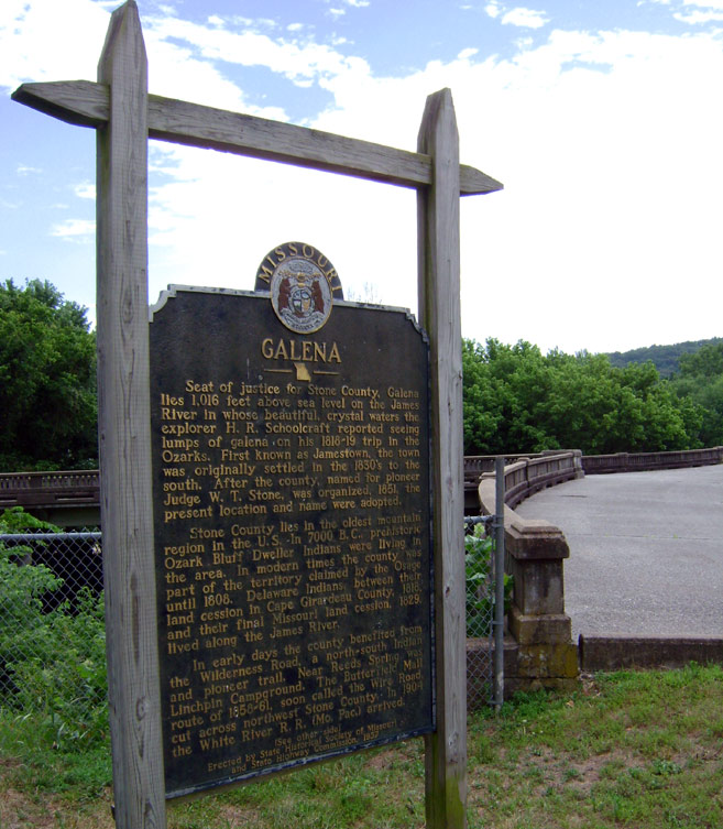
Here's an Ozarkbahn truism: small towns often harbor great marvels. That's the case with Galena, Missouri, a particularly scenic plat of the Ozark Mountains near Table Rock Lake and nearby tourist mecca Branson.

[Galena, MO, on Google Maps]

Galena's local notoriety began a century ago as bucolic float-trip destination for those who could afford to vacation by train and the emerging automobile. Located on the James River, the town's most visible trade still seems to be catering to fishing and canoeing enthusiasts. Galena does possess one macabre footnote in history: the site of the last public execution in America. In 1937, the county courts tried and hanged Roscoe "Red" Jackson, an Ozarks native and transient worker convicted of shooting a traveling salesman. Gawkers flocked to the town square, a spectacle residents remembered with a mix of disgust and awe. The whole affair sounds like a pain in the neck to me.


Today, civic pride and upkeep remains evident around the Galena town square. Years of re-purposing fail to hide a neato bungalow-style service station down the street.

For road-going sightseers, Galena's one bona fide curiosity is its Art Deco highway bridge shaped like a Y. Opened in 1927, it spans the James River between the town proper and what is now Highway 248, an artery of local commerce and travel dating back to the 1800s. The bridge was split at the end to aid drivers turning onto the curvy highway perched on the bluffs opposite Galena. Given the tepid braking and handling abilities of pre-war autos, the unique design was well-appreciated and enthusiastically received.


The Galena Y-Bridge is one of the more elegant and purposeful public works in the Ozarks.

Hundreds of people crowded the town for the dedication of the Y-bridge. Such an occasion might not stir the same excitement today, but it makes one appreciate a time when the general public was still captivated by the potential of the open road. The liberating notion of mobility and romance of motor-tourism are fully taken for granted today, with cars widely regarded as appliances to isolate the journey rather than enhance it.


The Y-Bridge dedication, as shown on Bridgehunter.com. The narrow 1910 steel bridge it replaced can seen in the background.

The Y-bridge was still a marvel in the early twentieth century based on practical reasons, as well. Accessibility was the historic challenge of the Ozarks, where steep valleys made river crossings a temperamental enterprise at the mercy of seasonal flooding. The proliferation of automobiles in the 1920s loosened state and federal road funding in Missouri, fostering a flurry of bridge construction in the area. At 764 feet long, the Galena structure was one of the larger undertakings in the Ozarks for the time, and a major asset to the town's tourist trade.


Modernity on the March. Concrete pylons remain from a narrow 1910 steel bridge that the Y-Bridge replaced. Turn your gaze 180 degrees, and the newer roadway bridge built in the 1980s can be seen. Despite its age and closure, the Y-bridge remains open to pleasant pedestrian views.

Ultimately, the Great Depression, steady rise of Branson, and attraction of surrounding lakes diverted the attention of many visitors away from the James River's banks. The Y-bridge now rests on the National Register of Historic Places, and Galena has survived time and floods to show pedestrians where progressive inspiration meets natural beauty.

August 8, 2010

From Camp Crowder to Camp Swampy

"You're not going to put this on your blog, are you?"

I stuffed my camera back in my pocket. "Nah, probably not."


Several months ago, some friends and I were scouting the desolate remains of the U.S. Army's Fort Crowder near Neosho, Missouri, for possible use in organizing outdoor events. We had permission to be there from the current owner, Crowder College, but exploring the derelict military installation seemed like a clandestine operation. Not for public consumption, and definitely not for blogging.

As I discovered, the site's history is too interesting to keep to myself.

Camp Crowder


Camp Crowder started life as an Army Signal Corps training base built during World War II. At its peak, its operations expanded to roughly 45,000 people stationed across a sprawling city of soldiers, block after block of barracks and drilling grounds. Crowder's ranks saw everything from basic training to specialized communications instruction, and even Axis prisoners of war.


Postcard from Flickr user "Smaddy."


Colorful visitors: Senator Harry Truman (born in nearby Lamar, MO), Cary Grant, and Congressman and necktie enthusiast Dewey Short. Images courtesy of the Missouri State Archives.


Swastikas marking the funeral of a German captive. Images courtesy of the Missouri State Archives.

Links ahoy:
[Missouri State Archives: Camp Crowder Photograph Collection]
[Newton County History]
[Camp Crowder postcard history]

Camp Swampy


Cartoonist Mort Walker, creator of comic strip Beetle Bailey and its spin-off television shorts, was stationed at Crowder during the Big One. When the comic strip began in 1950, Walker had no want for material - gags follow the toils and characters of base life.


No coincidences: Camp Swampy is Camp Crowder.

Among today's old, weathered stop signs and concrete footings was the ever-aloof Private Bailey, getting his neck wrung by the Sarge for napping against a half-painted door. We've seen how the L'il Abner comic was a uniquely Ozarkian endeavor, spawning its own "Dogpatch U.S.A." theme park near Jasper, Arkansas. Here is another real-life standard straight out of the Sunday funny pages.


Inspiring decades of worked shrugged by Private Bailey. Images courtesy of the Missouri State Archives.


Neither gender or racial sensitivity was up to modern norms, but look, there was a war on.
Rubber band gun from Volume 22.

Crowder's role diminished after the war, briefly becoming a rocket testing ground before dividing the land among Crowder College, the National Guard, and local industry. Most of the infrastructure was sold or demolished, but the more permanent works in asphalt and concrete remain. A web personal favorite of mine, Underground Ozarks, has some pictures of areas we were not able to cover.


Among the relics: a rusty desk, oil drums, and concrete blocks marked with weights of odd accuracy.


Touring the old base, the one thing that stands out is the remarkable pace of nature. Constructions erected with even military efficiency are no match for the Ozarks' relentless green tide. Trees grow in the middle of old roads, and herds of white-tailed deer roam the fields where neat rows of buildings once stood. Any low spot in the soil became fair game for a frog pond.


General Halftrack is long gone from Camp Crowder, and the past has faded rapidly. Like Beetle Bailey, Mother Nature is not one to take orders.